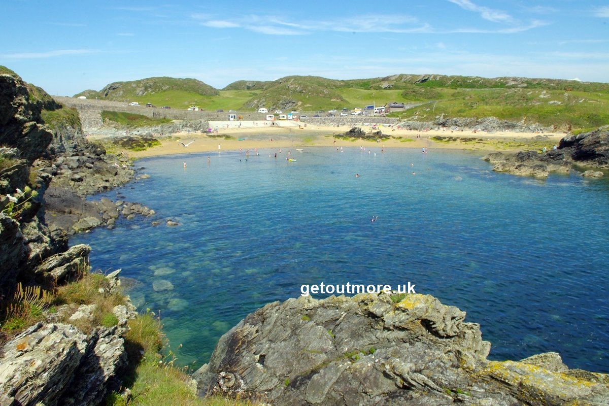
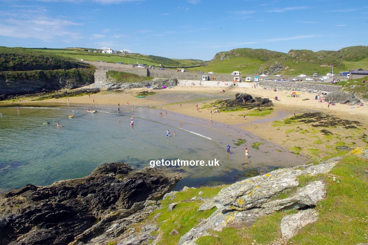
Porth Dafarch is a picturesque cove of course sand, just over a mile south-west of Holyhead on Anglesey's Holy Island. Owned by the National Trust, it usually attains a Blue Flag Award and is one of a series of small sandy coves flanked by rocks, and backed by a sea wall and the coast road (Lon Isallt). There is a separate access road for the beach, and (free) parking is available on this or along Lon Isallt behind the beach. Access to the shore is down steps or a slipway. A dog ban operates from 1st May until 30th September, and a Beach Warden is on duty from late May until early September. It's a popular beach for canoeing, surfing, coasteering and scuba diving, and is generally safe for swimming. Launching of power craft is not allowed.
Facilities include toilets, drinking water, cycle stands, picnic tables, refreshment vans (in summer) and a slipway onto the shore. Holyhead rail station is approximately 1¾ miles away, and the the beach can be reached along the appropriately named Porthdafarch Road. This begins opposite McDonalds / Asda and is mostly a rural road with a pavement all the way. It can get busy at peak times, especially around high tide, so be sure to check the tide times before visiting. There are plenty of camp-sites in the vicinity.
The photos were taken 2½ hours after low tide.